Winds are atmospheric phenomenon attributable to difference in temperature and atmospheric pressure. They are significant component in establishing and regulating the weather and climate of a particular place as well as of global atmospheric phenomenon. Winds operate in different climatic scale in terms of its spatial and temporal aspects. They operate at planetary scale known as planetary winds; seasonal scale known as seasonal or periodic winds and regional scale known as local winds.
Local winds are winds with limited spatial and temporal scale as they effect a limited area and operates over a shorter period of time. There are many ways in which local winds effect the weather and climate of a particular places. Many local winds blow over different regions of India. The influence of these local winds ins not only limited to the climate and weather but also shapes the economic, cultural and social characteristics of the region.
Local winds of India –
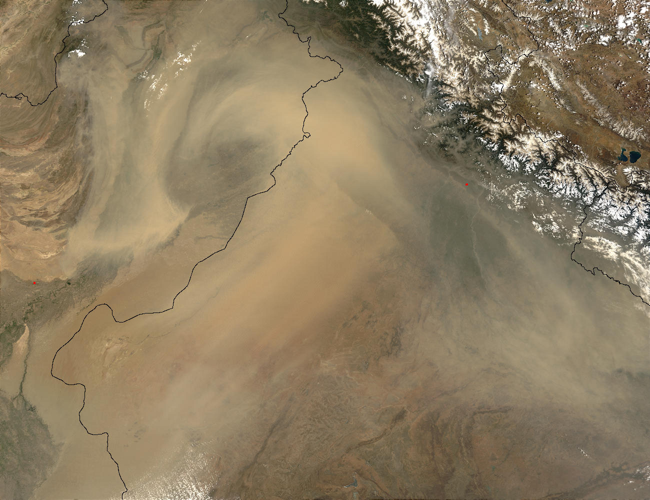
Aandhi, also known as Kali Aandhi are dust storms affecting the north western and central part of India. These storms are formed due to development of strong pressure gradient in the region late spring before monsoon season. Due to high surface heating in the dry Arabian Peninsula and the Thar desert, the loose soil/sand particles are transported through westerly winds to northern- central India (Middleton, 1986). These dust storms may become ferocious and cause destruction to life and property. The level of pollution in many urban centres like Delhi rises and the amount of suspended particles increase in air.
 |
| MODIS TERRA satellite image showing thick dust storms over India and Pakistan on June 9, 2003. Image courtesy - NASA |
Loo are hot, dry winds blowing throughout the daytime in north and western India during the month of May and June. Loo winds are developed due to formation of the Monsoon Low Pressure Trough in northern India. To maintain balance, the hot dry winds of the surrounding areas move in causing formation of Loo. These dry winds are responsible for loss of life due to dehydration. However, it has some positive influences as it facilitates the process of separating the chaff from the grain. There is also decline in number of insect borne disease like malaria due to decrease in mosquito population.
 |
| Kalbaisakhi winds hitting Kolkata on 24 May, 2010. Photo Courtesy - Biswarup Ganguly, Wikipedia
|
Kalbaisakhi are the local winds affecting the eastern Indian states of West Bengal, Assam, Bangladesh and parts of Odisha and Bihar. It is known as different names in different states. Kal- Baisakhi means 'a fateful thing' in the month of Baisakh (Roy and Chatterji, 1929). In Assam, these are called Tea showers and Bordolichilla, and in Odisha as Bordoisila or Bardoli Chhera. These pre-monsoonal winds originate in the Chhota Nagpur plateau and blows eastwards under the influence of Westerlies. These warm winds when come in contact with moisture laden air and moves over elevated Himalayas in Assam and North Bengal, results in sudden rise in wind speed, lightning, thunder and hail and sometimes destructive tornadoes. It can cause destruction by uprooting trees and small houses. But then again, they sustain the pre-kharif crops like jute and paddy, and a large number of vegetables and fruits till summer season.
Mango showers are rains bearing local winds known with many different names as April rains, summer showers, coffee showers and cherry blossom showers. Names with cultivation prefix has been given to these light rains as it is beneficial for their growth. These pre-monsoonal winds are mainly experienced in south India prevailing along the coast of Kerala, Karnataka and parts of Tamil Nadu. They originate in the Bay of Bengal as the result of thunderstorm development.
Elephanta is a post monsoonal local wind impacting the Malabar coast of India. These are south easterly moisture laden winds which announces the beginning of dry season after monsoons and end of the rainy season.
If you are more interested in winds; Earth, Windy, Windfinder are web based utilities which visualizes winds with wind direction, speed and other weather variables.
References -
Middleton, N.J. (1986), A geography of dust storms in South‐West Asia. J. Climatol., 6: 183-196. doi:
10.1002/joc.3370060207Roy, S., Chatterji, G. Origin of Nor'westers. Nature 124, 481 (1929). https://doi.org/10.1038/124481a0


